Koforidua
Koforidua, also popularly known as K-dua or Koftown, is a city and the capital of Eastern Region in southern Ghana. Koforidua was founded in 1875 by migrants from Ashanti. It is also called New Juaben. The city has a settlement city proper population of 183,727 people as of 2010, Koforidua is an amalgamation of two Municipalities; New Juaben North and South. The city has a blend of colonial and modern architecture.
Koforidua serves as a commercial center and Regional Capital for the Eastern region and New Juaben Municipal District. The city is home to many businesses, with the exception of heavy duty industries. The city is home to Intravenous Infusions Ltd., one of the oldest pharmaceutical companies in Ghana and West Africa, a leading producer of injections and drips. The company is listed on the Ghana Stock exchange and was registered in 1969. The city is home to many Government Departments and Ministries at the Regional level. The recent construction of the four-lane highway road linking the Koforidua Technical University and Koforidua to Oyoko brings commerce to the city. The highway also serves as a valid alternative route to reach Kumasi.
Oral tradition has it that, Koforidua owes its name to an Akan man, Kofi Ofori, who had built his hut under a huge mahogany tree. This tree provided shelter for weary farmers who were returning from their farms after a hard day's work. Over time, it became common for the farmers to say that they were going to rest under Kofi Ofori's tree. In Akan language, Twi, the word for tree is "dua". An amalgamation of Kofi Ofori's name and tree, therefore, becomes "Koforidua." Koforidua today is a multi-ethnic city with people from various ethnic groups in Ghana calling the city their home.
Map - Koforidua
Map
Country - Ghana
 |
 |
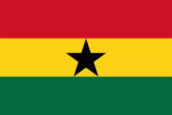
| Flag of Ghana | |
The Bono state existed in the area that is modern day Ghana during the 11th century. Kingdoms and empires such as Kingdom of Dagbon in the north and the Ashanti Empire in the south emerged over the centuries. Beginning in the 15th century, the Portuguese Empire, followed by other European powers, contested the area for trading rights, until the British ultimately established control of the coast by the 19th century. Following over a century of colonial resistance, the current borders of the country took shape, encompassing 4 separate British colonial territories: Gold Coast, Ashanti, the Northern Territories, and British Togoland. These were unified as an independent dominion within the Commonwealth of Nations. On 6th March 1957, Ghana became the first country in Sub-Saharan Africa to achieve sovereignty. Ghana subsequently became influential in decolonisation efforts and the Pan-African movement.
Currency / Language
| ISO | Currency | Symbol | Significant figures |
|---|---|---|---|
| GHS | Ghanaian cedi | ₵ | 2 |
| ISO | Language |
|---|---|
| AK | Akan language |
| EN | English language |
| EE | Ewe language |
| TW | Twi |


